How to access the application
How to access ARIES for PEOPLE-EA via a web-browser
Once registered, following the instruction in the page above, use this link:
https://peopleea.integratedmodelling.org/modeler/?app=aries.peopleea.en
Spatial and temporal context of the analysis
At the top of the menu on the left side of the screen, you can specify the geographic area and temporal and spatial scale.
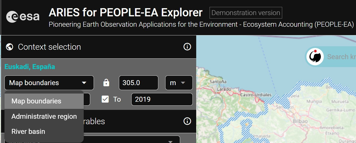
Where
At the top of the panel, there a drop-down menu provides three options to select an analysis context by zooming and panning on the map. When the "administrative regions" or "river basin" option is chosen, the currently highlighted context will be outlined in light blue.- Map boundaries: Select an area of interest by panning and zooming in/out. The entire area visible on the screen becomes your analysis context.
- Administrative regions: This option automatically identifies the largest administrative entity (e.g., Country or Subnational Unit) in the area selected, according to the M49 standard endorsed by the UN. By zooming in, the user can choose a smaller administrative region. We recommend this option for novice users, as it offers a simple way to identify standard administrative boundaries for ecosystem accounting.
- River basin: This option selects an area of land draining to a specific water body based on FAO Hydrological Basins (simplified).
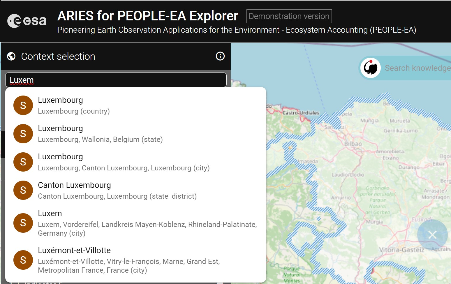
- Alternatively, the user can also directly type the name of a geographical context (i.e., country, region, city, or other geographic entity) in the ARIES for PEOPLE Search bar, starting with a capital letter.
These names are queried from the OpenStreetMap (OSM) database. Users should be aware that OSM boundaries may differ slightly from those selected using the "Administrative regions" option of the drop-down menu (i.e. a context selected with this option include the country's territorial waters)
- Countries are warmly invited to provide their official boundaries in case the default options currently integrated in ARIES to identify geographical boundaries don not meet the expected NSO's specification.
Spatial resolution
The user can select the spatial resolution for analysis, and choose between meters or kilometers.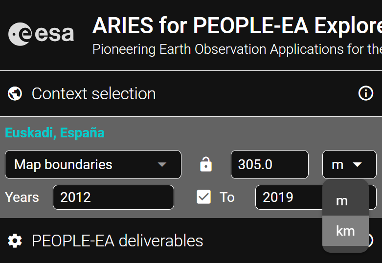
In case the resolution set is higher than the available input data, ARIES will compile accounts at the selected resolution, but based on the finest grained available data.When
Select the year(s) for your analysis. If data are missing for a specific year of interest, nad the option of temporal mediation is enabled, ARIES automatically fills the gap using the closest available year's data.
By default, the context is set to compute results for 2018, which corresponds to the latest year the Corine land cover dataset, this being one of the most important input of the output produced in the application. The user cna observe result for a single year, or for a longer period of time:
I. Single-year analysis (the box in this section is unchecked) and select the year of interest
II. Multi-year analysis - to show change over a longer period of time check the box and select the first and last year of the period to analyze.
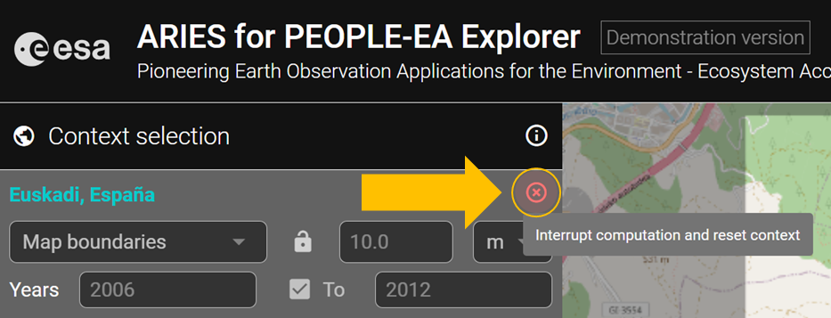
Reset
The red "X" button on the upper right can be used to reset a previously selected context, or to stop a computation in progress (all computed results will be lost).